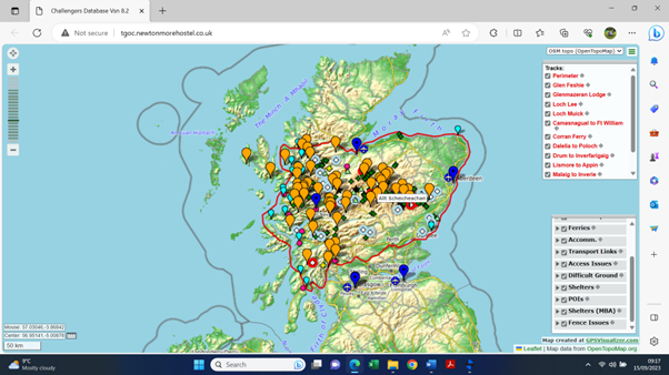

The Challenge boundaries are:
West – Western seaboard of mainland Scotland from Torridon south to Ardnamurchan Point, across to eastern Mull (Dervaig to Srathcoil), then by Oban (including Kerrera and Lismore), down coast to Crinan, the Crinan Canal to Ardrishaig, across Loch Fyne to Otter Ferry, south to Portavadie.
South – Mainland coast around Kyles of Bute, Firth of Clyde and Loch Long to Arrochar, Tarbet, south along Loch Lomond to Rowardennan (to include Ben Lomond), east following Duchray Water to Aberfoyle, Rob Roy Way to Callander, A84/A920/A9 to Doune, Dunblane and Perth, north side of Tay Estuary to Arbroath.
East – The eastern seaboard from Arbroath to Fraserburgh.
North – North coast from Fraserburgh to Inverness, north shore of the Beauly Firth (but not Moray Firth) to Muir of Ord, A832/A896 to Achnasheen, Kinlochewe and Torridon.
Click on the screenshot below for an interactive map of the Challenge area.