

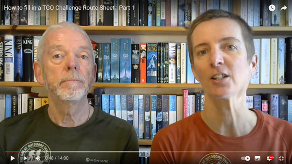
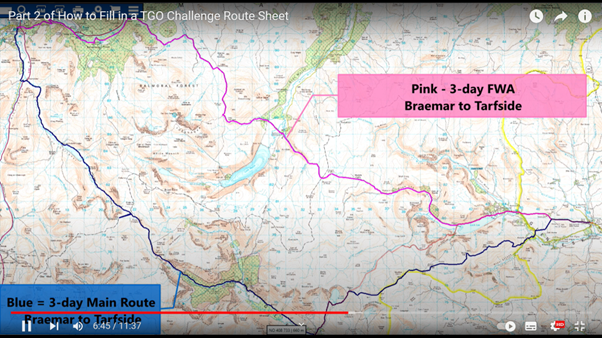
So you have your route planned and you know where you are planning to walk each day and where you propose to stop each night. The next job is to get it onto a TGOC24 route sheet. Don’t worry – having your route vetted shouldn’t feel like having your homework marked nor is it about your computer skills. It is much more about checking the feasibility and safety of your route and that it fits with your level of experience. To help you, Mick & Gayle have made two videos which are now available on the TGO Challenge YouTube channel at www.youtube.com/@TGOChallenge. One gives help on presenting your main route and the second on how to document your Foul Weather Alternatives (FWAs). Click on either image below to watch them.
If you prefer written information you should find what you need in the Filling in your Route Sheet document, which contains a checklist to use before you submit your route. A Phone-in location list is also available. Any place on this will be accepted but you can use other locations with a known mobile signal, access to a landline or to WiFi if you want to use WhatsApp.
We try to be as flexible as possible but with over 200 route sheets to deal with during the Event, Challenge Control does need a degree of standardisation and they also need to be able to quickly ascertain where you are likely to be in case there is concern about your welfare, a need to let people in a certain area know of a hazard or, very rarely, because we are handing the route sheet over to Mountain Rescue.
Four ways to help Challenge Control use your route sheet.
The videos and document should cover everything you need to know but below we have highlighted three things, which might seem counterintuitive, that will help Challenge Control and your vetters to assess and use your route sheet more easily.
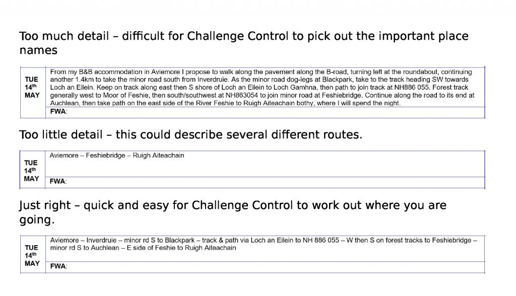
Route description – It may surprise Challengers that, rather than too little detail in the route description, the bigger problem is often too much. It’s the place names and compass directions we rely on most so they need not to be crowded out by unnecessary text. Cutting out linking words like “continue”, “follow” “along” and “take” can make the route much quicker to ascertain. An example, used in the first video, is shown below for a route from Aviemore to Ruigh Aiteachain bothy.
Grid references – Too many of them can make it a slow job to work out our route. A place name taken from a 1:50k Ordnance Survey map describing where you will be is much quicker for Challenge Control to locate than manually or digitally searching for a grid reference. Every grid reference will be checked by your vetter, which is quite time consuming, so please only use them in the main description when necessary. We also ask that you include the prefix letters and only give 6 figures (3 eastings and 3 northings) e.g. NM 126 889. Mick and Gayle are currently producing a video on UK grid references for those overseas Challengers who are unfamiliar with them.
Place names only on 1:25,000 maps – Where possible please avoid these. Why? Challenge Control and your vetters mainly use 1:50k maps as we generally need an overview of your route. Another reason is that on most digital mapping systems you cannot search on a name that only appears on the 1:25k map. So when you are describing your route please use the 1:50k map to look for suitable place names. There are a few occasions when a name on the 1:25k is the only alternative to an unnamed grid reference. When that is the case just add (1:25k) after the name and we’ll know to flip maps.
Overnight Halt Point names. Please give us a place name in this column with a grid reference if this is a wild camp. Why is this important? In effect it’s a quick reference guide to your route – essential when Challenge Control has to ascertain, potentially in an emergency, who is likely to be where. The experienced eyes of Challenge Control can quickly ascertain your route even if you think some of the places you have named are a bit obscure! If you are staying in a town or village, please give us the name and phone number of any prebooked accommodation. If you are planning to book something further down the line, just amend your route sheet and send it to us in the Spring. The example below is the overnight halts for the first half of a route from Mallaig to Dalwhinnie. The second column if far more useful to Challenge Control than the first.